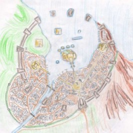
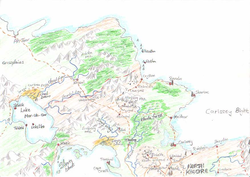
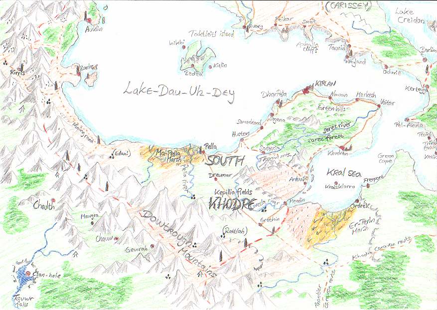
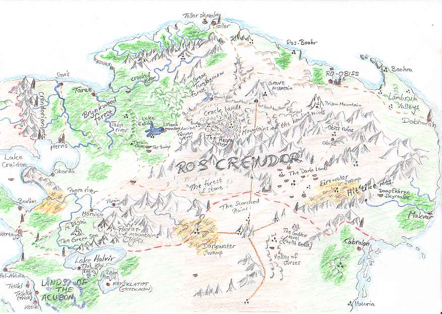
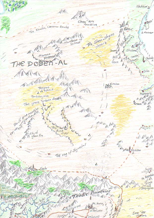
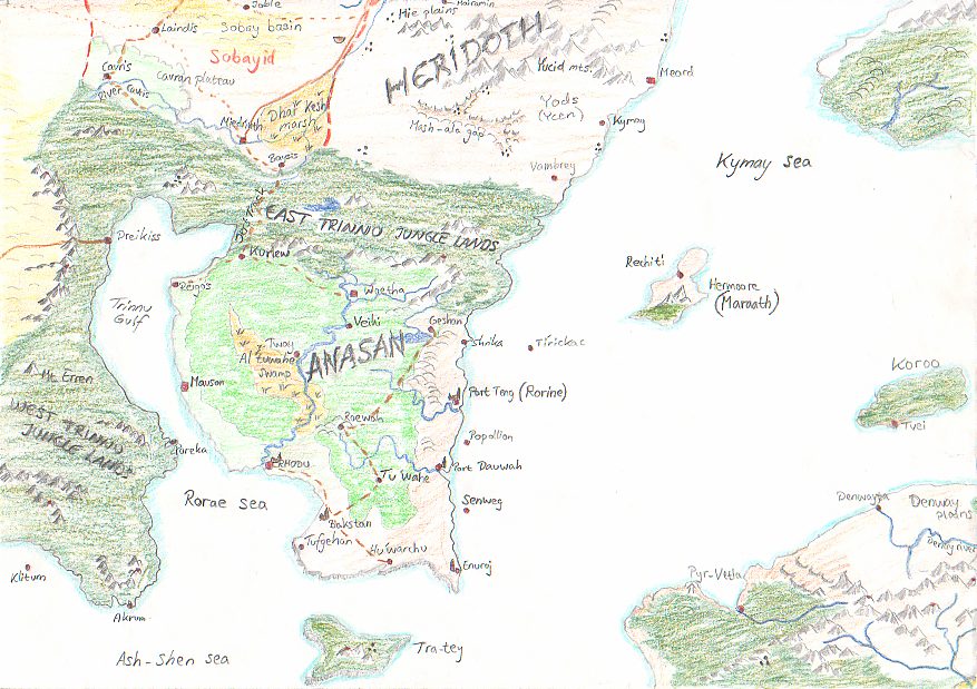
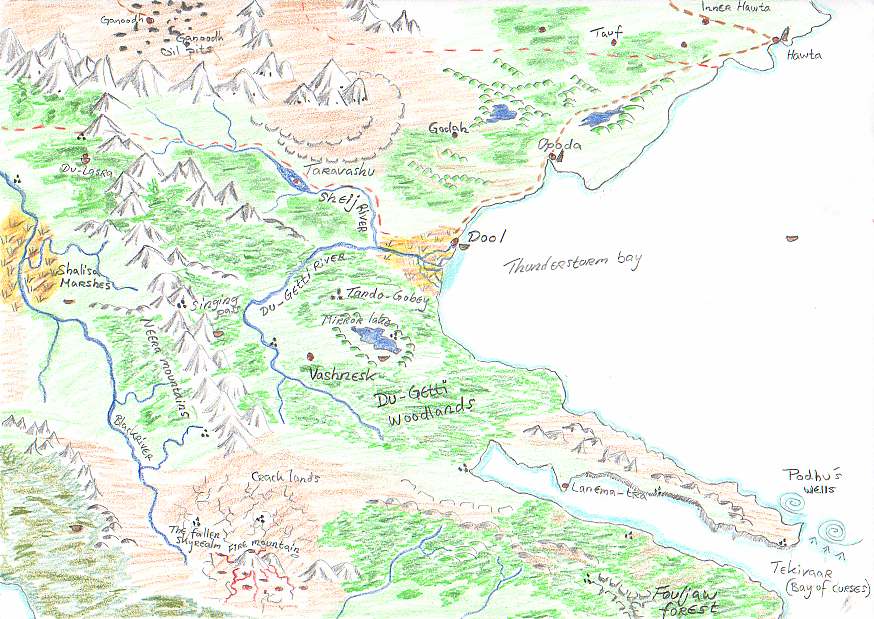
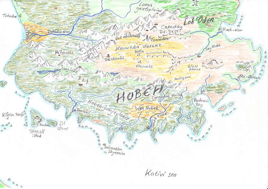
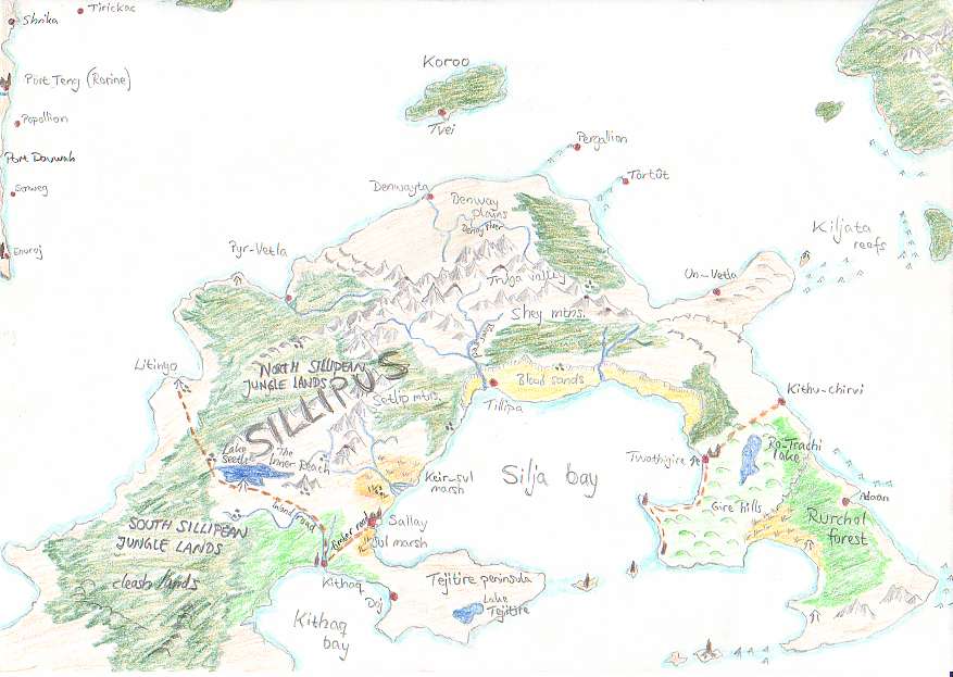
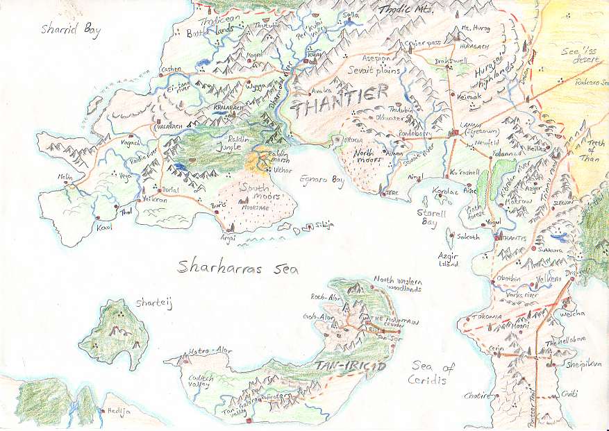
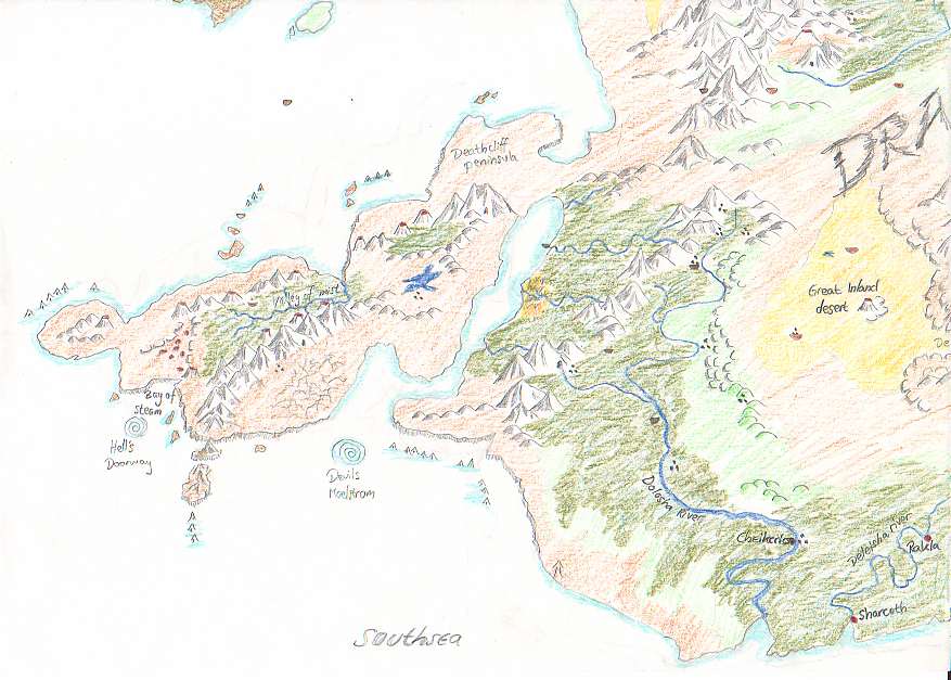
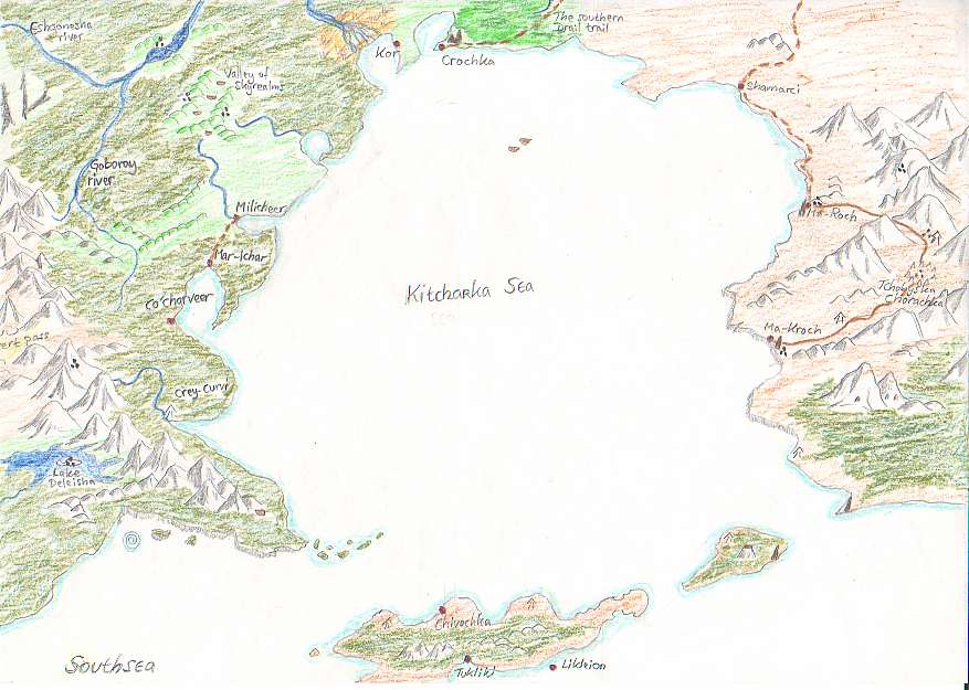
The maps that I have drawn over the years cover the parts of Jorune where the characters of my players have spent most of their time and experienced most of their adventures. Therefore, not all parts of Jorune have been mapped.....yet. The maps are crude and lack all the smaller details such as streams, smaller lakes, individual mountain valleys, villages etc. When using the maps one should be aware that so much more exists when examining the lands up close, than is shown on the large scale maps.
The maps generally cover either geographical areas or towns/cities. I have tried to model the geographical maps after the maps over Middle-Earth, published by Iron Crown Enterprises for the RPGs Rolemaster and M.E.R.P.
NOTE: All maps are scanned at a low resolution, but can be obtained from the sholari in higher resolution. |

